

blah blah blah
Carter Lakes
Length: 7.8 miles out-and-backDifficulty (click for info): Moderate
Elevation Gain: 1940 feet (+130 feet on return)
Rating (click for info): 7/10
Elevation: 3268'
Driving Directions:
Trailhead and parking area are on Rt. 16 in Green's Grant, NH (the lakes are in Bean's Purchase). The parking area is on the east side of the road, 6.8 miles south of Rt. 16's eastern junction with Rt. 2 and 12.8 miles north of its northern junction with Rt. 16A. Click here for a Google map.
About the Hike:
Nestled in a tiny valley south of Carter Notch along with AMC's Carter Notch Hut, these two small ponds are surrounded by striking cliff and boulder scenery. Access is via the Nineteen-Mile Brook Trail, which follows the brook of the same name for much of the way and passes many pleasant cascades and pools. There is also some fine forest walking to enjoy, as grades are easy the whole way.
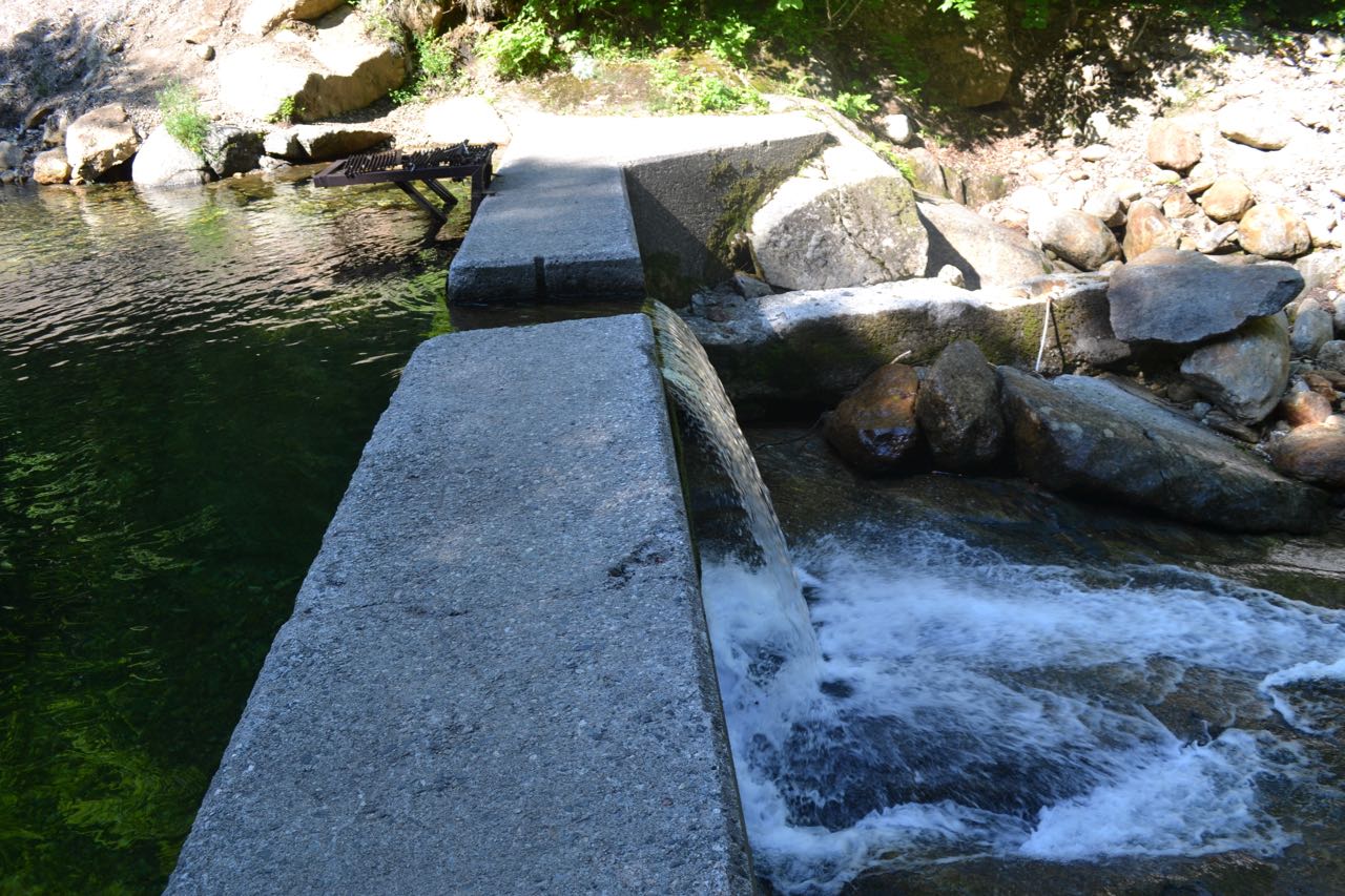
Leave the parking area on Nineteen-Mile Brook Trail and immediately begin following the brook on a wide dirt path, climbing gradually. After a short stretch close to the brook, the trail begins to pull away. After crossing a bridge over a tributary, it soon heads back and continues easily along the bank, passing an open area above a small waterslide. It again follows the brook closely except through a relocation which heads up and over a small knoll to bypass storm damage. Several more cascades are passed in this section. At just over one mile from the parking area, the trail crosses another tributary on a larger, recently built bridge, then leads back to Nineteen-Mile Brook, where it passes a cement dam. From here, it continues along the brook, but at a greater distance, gradually splitting off. In 0.7 miles from the dam, pass Carter Dome Trail on the left.
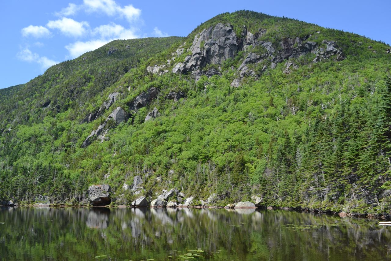
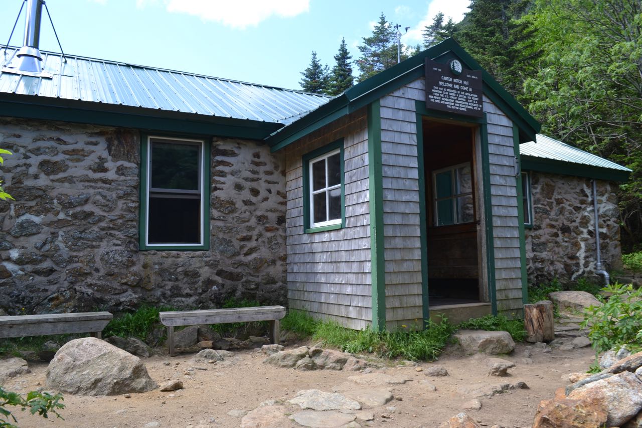
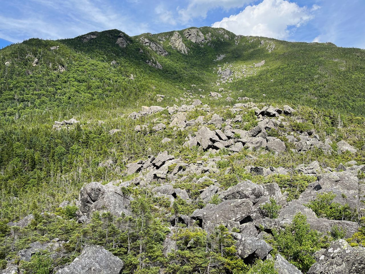
The trail then crosses two more brooks on small bridges and ascends steadily through the forest, now far from the brook. After a mile of easy climbing, it crosses one last small brook, then climbs a stone staircase, after which the terrain becomes rockier. Another half mile of climbing leads to Carter Notch, where Wildcat Ridge Trail goes to the right and the trail joins the Appalachian Trail. Having crossed its highest point, the trail now descends 100 feet to Upper Carter Lake, where several openings on the shore provide amazing views across the water to the cliffs of Wildcat Mountain. At the far end of this pond, Carter-Moriah Trail, along with the Appalachian Trail, goes to the left to climb Carter Dome. Continue along the trail to the north shore of Lower Carter Lake, where you can look across to the boulder field known as The Rampart. Further down, another nice sitting spot has views up to the cliffs of Carter Dome, on the opposite side of the notch. The Carter Notch Hut and the end of the trail are just a short distance beyond this. Continue around the corner of the hut and up a staircase, following signs for Wildcat River Trail, to venture out to what many consider the highlight of the notch, The Rampart. Walk between the buildings and head away from the hut for a short distance and turn left at the sign pointing the way to The Rampart. Follow this short spur downhill and to the edge of the jumble of boulders. Use caution if you climb up onto them, as the gaps between the boulders are narrow and deep. From the edge of the opening, you can survey the vast expanse of huge rocks intermingled with stunted trees, which cascades down the sprawling mountainside. If you climb high enough, you can see out over the valley to the south of the notch and to some of the mountains beyond.
Printable directions page